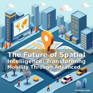
The Future of Mobility Mapping: Innovations Shaping Intelligent Transportation Solutions
In an era defined by rapid technological advancement, mobility mapping has evolved from simple location tracking to a complex ecosystem of interconnected systems that redefine how we navigate our world. As cities grow denser and transportation demands become increasingly dynamic, innovative mapping solutions are emerging as critical tools for urban planners, logistics providers, and everyday commuters alike.
This exploration delves into the cutting-edge technologies transforming modern mobility maps, including AI-driven geospatial analysis, real-time traffic prediction models, and crowd-sourced data integration. These advancements not only enhance route optimization but also enable predictive maintenance of infrastructure through spatial analytics.
Revolutionizing Urban Navigation Through Smart Mapping Technologies
The foundation of intelligent mobility mapping lies in its ability to process vast amounts of geographic data while maintaining user-friendly interfaces. Modern platforms integrate satellite imagery with ground-level sensor networks to provide hyper-localized information down to street level accuracy.
One groundbreaking development is the incorporation of augmented reality overlays within mobile navigation apps. This allows users to see virtual directions superimposed onto their physical surroundings, dramatically improving wayfinding experiences in unfamiliar environments.
- Spatial Data Fusion: Combining GPS coordinates with LiDAR scans creates three-dimensional city models useful for autonomous vehicle path planning
- Predictive Analytics: Machine learning algorithms analyze historical traffic patterns to forecast congestion points hours before they occur
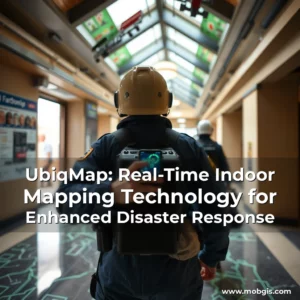
These capabilities extend beyond personal navigation devices; emergency services now utilize advanced mapping systems to optimize response times during crises. Fire departments can simulate optimal routes based on current road conditions and building layouts using integrated GIS platforms.
The integration of IoT sensors along roadways provides continuous streams of real-time data about traffic flow, weather conditions, and even pedestrian movement patterns. This constant influx of information enables adaptive signal timing adjustments at intersections, reducing overall travel delays across urban areas.
Evolving Standards in Location Accuracy for Mobile Applications
As consumer expectations rise, developers must continually refine location precision to meet demand for seamless digital experiences. Current standards have shifted from basic latitude/longitude tracking towards multi-layered positioning systems incorporating barometric pressure readings and magnetic field detection.
A significant leap forward comes from the adoption of hybrid positioning techniques that combine traditional GNSS signals with cellular network triangulation. This dual-source approach ensures reliable location fixes even in densely built environments where satellite reception may be limited.
Quantifying Precision Improvements Over Time
Industry benchmarks show remarkable progress over recent years. In 2018, average smartphone location accuracy ranged between 5-15 meters. By 2023, this figure had improved significantly, with most high-end devices achieving sub-meter precision under ideal conditions.
This enhanced accuracy has direct implications for ride-sharing services, allowing drivers to pinpoint pickup locations with greater certainty. It also benefits delivery companies by enabling precise drop-off coordination, reducing time spent searching for exact addresses.
For outdoor recreation enthusiasts, these improvements mean safer hiking trails with accurate trail markings and emergency beacon functionality. The increased reliability of location data contributes to better safety outcomes in remote wilderness areas.
Developers continue pushing boundaries by integrating dead reckoning algorithms that maintain position estimates when satellite signals are temporarily lost. This feature proves invaluable during tunnel traversals or in underground parking facilities where standard GPS fails.
Integrating Real-Time Traffic Analysis Into Mobility Platforms
Modern mapping applications go beyond static representations of roads and buildings by continuously updating traffic conditions from various sources. This includes data feeds from connected vehicles, municipal monitoring systems, and even social media reports about incidents.
The implementation of machine learning models trained on massive datasets allows these platforms to predict traffic disruptions long before they materialize. For example, sudden rain showers might trigger algorithmic rerouting suggestions preemptively rather than waiting for actual congestion buildup.
Advanced systems employ probabilistic forecasting methods that consider multiple variables simultaneously. Factors such as school dismissal times, sporting event schedules, and construction timelines all influence predicted traffic flows.
Some leading platforms offer personalized traffic alerts tailored to individual driving habits. If a user frequently takes a particular route during morning commutes, the system learns preferred departure windows and proactively suggests alternative paths during known peak periods.
Leveraging Crowd-Sourced Data for Dynamic Map Updates
The power of collective intelligence is being harnessed through crowd-sourced mapping initiatives that allow users to contribute real-world observations. This participatory model transforms passive consumers into active contributors who help maintain up-to-date geographical records.
Applications range from reporting potholes and road closures to identifying new businesses opening in previously unmarked locations. Many mapping services incentivize participation through gamification elements like achievement badges or local reputation scores.
One particularly impactful application involves disaster response scenarios. During natural disasters, volunteers can rapidly update affected regions’ status, providing crucial information to relief organizations navigating damaged infrastructure.
Crowd-sourcing also plays a vital role in language localization efforts. Users often submit translations for map labels, ensuring culturally relevant terminology appears in different linguistic contexts worldwide.
Data privacy remains a paramount concern in these collaborative mapping ecosystems. Reputable platforms implement strict anonymization protocols and transparent data usage policies to protect contributor identities while still benefiting from aggregated insights.
Autonomous Vehicle Navigation: The Next Frontier in Mobility Mapping
The rise of self-driving technology necessitates unprecedented levels of mapping precision and data richness. Autonomous vehicles rely on highly detailed digital twins of their operating environments to make split-second decisions safely.
Creating these intricate maps requires extensive laser scanning operations combined with photogrammetric surveys. The resulting point cloud data forms the basis for HD maps used in robotic perception systems.
Unlike conventional maps that focus primarily on road networks, autonomous vehicle maps include information about lane markings, curbside features, and even temporary obstacles like parked cars or construction barriers.
Ongoing updates pose another challenge since changes in infrastructure happen constantly. Specialized mapping fleets equipped with lidar sensors patrol streets regularly to capture any modifications requiring immediate database revisions.
Vehicles themselves contribute to this evolving dataset through V2X communication protocols that share environmental awareness among connected automobiles. This mesh network enhances situational understanding beyond what any single car could achieve independently.
Bridging the Gap Between Traditional Cartography and Digital Mapping Systems
The transition from paper-based cartographic traditions to digital mapping represents more than just a technological shift—it signifies a fundamental transformation in how geographic knowledge is produced and consumed.
Digital mapping platforms enable interactive exploration of topographical features, demographic distributions, and infrastructural developments in ways never before possible. Users can zoom seamlessly between global perspectives and microscopic details without needing to consult multiple reference materials.
Historical layers add yet another dimension to modern mapping capabilities. Some platforms allow users to compare present-day landscapes against archival photographs dating back decades or even centuries.
This temporal aspect becomes especially valuable for academic research, urban planning studies, and climate change impact assessments. Scholars can track land-use transformations over extended periods with unprecedented granularity.
The open-source nature of many contemporary mapping frameworks fosters innovation by allowing developers from around the world to build upon existing foundations rather than starting from scratch each time.
Fostering Global Collaboration Through Open Source Mapping Initiatives
Open source mapping projects have democratized access to sophisticated geographic tools, empowering communities everywhere to create and maintain their own localized maps. These initiatives promote transparency and inclusivity in spatial data management practices.
Platforms like OpenStreetMap serve as prime examples of crowdsourced mapping success stories. They’ve grown into robust resources containing detailed street-level information contributed voluntarily by millions of individuals globally.
Such collaborative approaches prove particularly beneficial in developing regions where official mapping data might be outdated or incomplete due to resource constraints. Local residents can quickly update missing information regarding new roads, schools, or healthcare facilities.
Academic institutions and non-profit organizations frequently leverage open source mapping tools for humanitarian purposes. From tracking disease outbreaks to managing refugee settlements, these technologies support critical decision-making processes worldwide.
Despite their advantages, open source mapping projects face challenges related to quality control and consistency standards. Maintaining uniformity across diverse contributions requires ongoing moderation efforts by dedicated volunteer teams.
Ensuring Ethical Considerations in Advanced Mapping Technologies
As mapping solutions become more powerful, ethical dilemmas surrounding data collection, storage, and usage require careful attention. Balancing innovation with responsible stewardship of sensitive location information presents a growing challenge for industry stakeholders.
Transparency in data sourcing practices helps build trust with end-users. When mapping services clearly disclose which datasets inform their analyses, users gain confidence in the reliability of presented information.
Privacy-preserving techniques such as differential privacy algorithms ensure that aggregate statistical outputs don’t inadvertently reveal personally identifiable information about individuals.
Regulatory compliance adds another layer of complexity, particularly concerning cross-border data transfers. Companies must stay abreast of evolving legal requirements governing geolocation data handling procedures internationally.
Public engagement initiatives play a crucial role in shaping responsible mapping practices. Involving community members in discussions about acceptable uses of location data promotes broader societal acceptance of these transformative technologies.
Conclusion
The evolution of mapping solutions continues to reshape every facet of modern life, offering unprecedented opportunities for smarter, more efficient mobility systems. From enhancing daily commutes to revolutionizing emergency response mechanisms, these innovations demonstrate immense potential for positive societal impact.
As stakeholders across industries embrace these technologies, prioritizing ethical implementation alongside technical excellence will determine whether future mapping solutions benefit everyone equitably or risk exacerbating existing disparities. The path ahead promises continued breakthroughs that will further blur the lines between physical spaces and digital representations thereof.
news is a contributor at MobGIS. We are committed to providing well-researched, accurate, and valuable content to our readers.