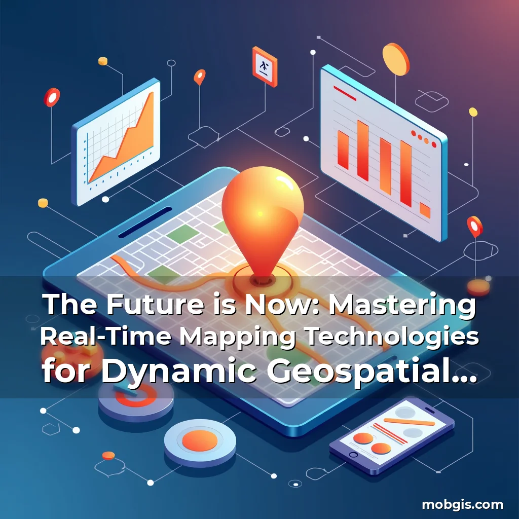
The Future is Now: Mastering Real-Time Mapping Technologies for Dynamic Geospatial Applications
In an era defined by data-driven decision-making, real-time mapping has emerged as a transformative force across industries ranging from urban infrastructure management to emergency response systems. This technology allows us to visualize and analyze spatial information as events unfold, creating unprecedented opportunities for proactive problem-solving and strategic planning.
At its core, real-time mapping combines geospatial analytics with live data streams to create dynamic representations of our world that evolve continuously. As mobile devices become ubiquitous and sensor networks expand globally, the ability to monitor changes in real time has never been more critical or accessible.
Understanding the Foundations of Real-Time Mapping
To grasp the significance of real-time mapping, we first need to understand its underlying components. A robust system typically consists of three key elements: data acquisition through sensors and GPS, advanced processing algorithms capable of handling massive datasets, and visualization platforms that render these complex interactions in user-friendly formats.
Data collection forms the bedrock of any real-time mapping application. From IoT-enabled traffic cameras capturing congestion patterns to drones equipped with LiDAR scanning construction sites, modern technologies generate vast amounts of geospatial data at incredible speeds.
The second component involves powerful backend systems designed specifically for temporal analysis. These systems must process incoming data at rates often exceeding thousands of transactions per second while maintaining accuracy within millisecond tolerances.
Finally, visualization tools play a crucial role in making sense of this continuous flow of information. Interactive maps enable users not only to observe but also interact with their environment in ways previously unimaginable, facilitating better situational awareness during crises or operational scenarios.
- Sensors: Include everything from traditional GPS units to cutting-edge AI-powered image recognition systems embedded in smartphones and wearables
- Processing Power: Requires cloud-based architectures with distributed computing capabilities to handle high-volume, low-latency requirements
- User Interfaces: Must balance technical complexity with intuitive design principles to ensure usability across diverse professional domains
Real-Time Mapping Across Industries
No single industry benefits exclusively from real-time mapping; rather, each sector adapts the technology to suit its particular needs. Logistics companies use it for fleet optimization, healthcare professionals track disease outbreaks using spatial epidemiology models, and environmental scientists monitor climate change indicators through satellite imagery feeds.
Urban planners have embraced real-time mapping to manage smart city initiatives effectively. By integrating traffic flow data with public transportation schedules, cities can dynamically adjust bus routes or signal timings based on current conditions, significantly improving commuter experiences.
Emergency services represent another vital area where real-time mapping makes life-saving differences. During natural disasters, rescue teams utilize updated topographic maps combined with social media sentiment analysis to identify areas requiring immediate attention without relying solely on outdated paper charts.
Differentiating Real-Time vs Near-Real Time Systems
It’s essential to distinguish between true real-time and near-real time mapping solutions since both serve distinct purposes depending on application contexts. True real-time systems update every few seconds or less, whereas near-real time updates occur minutes later after initial capture.
This distinction matters greatly when considering applications such as autonomous vehicle navigation versus long-term ecological research projects. Autonomous vehicles require instantaneous updates due to safety constraints, while researchers might accept slight delays for more accurate data aggregation over extended periods.
Choosing the appropriate type depends heavily on factors like required precision levels, acceptable latency thresholds, and available infrastructural resources. For instance, financial institutions dealing with stock market fluctuations demand strict adherence to true real-time standards to maintain competitive advantages.
In contrast, agricultural monitoring programs may operate comfortably within near-real time frameworks since crop growth cycles naturally accommodate longer observation windows before significant changes manifest visually detectable patterns.
The Role of Big Data Analytics in Enhancing Real-Time Mapping Capabilities
Big data analytics serves as the backbone of effective real-time mapping implementations. With petabytes of location-related information generated daily, sophisticated analytical techniques are necessary to extract meaningful insights quickly enough to support timely decisions.
Predictive modeling becomes particularly valuable here. By analyzing historical trends alongside current observations, analysts can forecast potential issues before they escalate into full-blown problems – whether predicting road accidents based on weather patterns or anticipating power grid failures during heatwaves.
Machine learning algorithms further augment these capabilities by identifying subtle correlations invisible to human observers alone. Neural networks trained on millions of past incidents learn to recognize early warning signs associated with various phenomena, enabling preemptive actions that save lives and prevent economic losses.
Challenges and Limitations Facing Modern Real-Time Mapping Systems
Despite its many advantages, implementing successful real-time mapping solutions presents several challenges that organizations must address proactively. One primary concern revolves around ensuring consistent connectivity across disparate network environments where disruptions could compromise data integrity or cause unacceptable delays.
Data security remains another pressing issue given the sensitive nature of much geospatial information. Unauthorized access attempts targeting critical infrastructure control systems pose serious risks that require multi-layered protection strategies incorporating encryption protocols and biometric authentication mechanisms.
Scalability represents yet another hurdle worth mentioning. As more entities adopt real-time mapping technologies simultaneously, existing infrastructures might struggle under increased demands unless properly upgraded beforehand. Cloud providers must continually enhance their offerings to meet rising expectations regarding performance reliability and cost-efficiency ratios.
Evolving Standards and Best Practices in Real-Time Mapping Implementation
Industry standards continue evolving rapidly as new innovations emerge regularly. Organizations committed to leveraging real-time mapping must stay informed about emerging guidelines related to interoperability specifications, ethical considerations surrounding privacy concerns, and regulatory compliance requirements affecting global deployments.
A growing emphasis now focuses on open-source software development communities contributing significantly towards democratizing access to otherwise expensive proprietary tools. Initiatives promoting standardized APIs facilitate easier integration between different platforms enhancing overall ecosystem flexibility.
Moreover, there’s increasing interest in developing universally applicable benchmark metrics allowing fair comparisons among competing real-time mapping solutions regardless of vendor affiliations or regional restrictions imposing artificial limitations upon cross-border collaborations.
Fostering Innovation Through Community Collaboration
The MobGIS community plays a pivotal role in advancing real-time mapping technologies forward collectively rather than individually pursuing isolated advancements. Collaborative efforts help accelerate progress by pooling expertise from varied backgrounds leading ultimately toward breakthrough discoveries benefiting everyone involved.
Shared knowledge repositories containing case studies demonstrating practical applications provide invaluable reference materials helping newcomers navigate complex implementation processes successfully without repeating common pitfalls encountered historically.
Regularly scheduled workshops focusing on hands-on training sessions give participants direct experience working with actual datasets reinforcing theoretical understanding through experiential learning methods proven highly effective within educational settings worldwide.
Towards a More Connected World Powered by Real-Time Mapping
As technological capabilities advance relentlessly, so too does our capacity to harness real-time mapping for even greater societal benefit. Future developments promise enhanced predictive accuracy driven by quantum computing breakthroughs potentially revolutionizing how we interpret vast quantities of geospatial intelligence instantaneously.
Meanwhile, augmented reality interfaces integrated seamlessly with real-time map overlays offer exciting possibilities transforming everyday experiences dramatically. Imagine navigating unfamiliar streets guided entirely by immersive digital overlays projecting relevant contextual information directly onto your field of view without needing physical signage.
Such innovations underscore why investing wisely in real-time mapping infrastructure today lays solid foundations for tomorrow’s interconnected world ready to tackle whatever challenges lie ahead confidently armed with superior spatial awareness capabilities surpassing anything achievable previously.
By embracing these advances thoughtfully while remaining vigilant against associated risks responsibly managing responsibilities tied closely together ensures sustainable growth trajectories aligned perfectly with broader goals aimed squarely at improving quality-of-life outcomes universally applicable across cultures and geographic regions alike.
Conclusion
Real-time mapping stands poised to redefine how societies function fundamentally altering relationships between individuals and their environments permanently reshaping perceptions about what constitutes ‘normal’ expectations concerning accessibility information availability speed response times etcetera.
For those engaged actively within MobGIS circles or simply curious observers contemplating future implications stemming from ongoing digitization waves sweeping across globe broadly speaking adopting proactive stances exploring opportunities afforded via real-time mapping promises substantial rewards outweighing whatever temporary inconveniences inevitably accompany transitions inherent whenever disruptive technologies gain widespread adoption status globally.
news is a contributor at MobGIS. We are committed to providing well-researched, accurate, and valuable content to our readers.