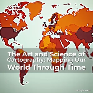
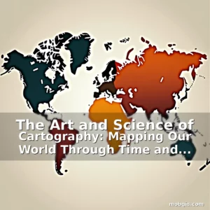
The Art and Science of Cartography: Mapping Our World Through Time and Technology
In an age where digital maps are at our fingertips and global navigation is effortless, the ancient practice of cartography remains as vital today as ever before. From hand-drawn parchment maps used by explorers centuries ago to high-resolution satellite imagery guiding modern urban development, cartography has evolved dramatically while maintaining its core purpose: representing spatial information in ways that inform, inspire, and guide us through our world.
This exploration delves deep into the multifaceted discipline of cartography, uncovering how this field bridges artistry with scientific precision. Whether you’re a professional geographer, a GIS specialist, or simply curious about the maps that shape your daily life, understanding the principles behind map creation offers profound insight into how we perceive and interact with space.
Historical Foundations of Map-Making
The roots of cartography stretch back thousands of years, beginning with early humans marking trails on cave walls and evolving into complex representations of terrain and celestial bodies. Ancient civilizations such as the Babylonians, Egyptians, Greeks, and Chinese developed their own methods of mapping territories, often blending empirical observation with mythological elements to create symbolic depictions of the known world.
Egyptian priests created some of the earliest recorded maps around 2600 BCE, using them primarily for land surveying after the annual flooding of the Nile River. These maps were essential for re-establishing property boundaries and ensuring fair taxation, demonstrating the practical applications of cartographic knowledge long before the term even existed.
- Clinometric Maps: Developed by the Romans, these topographical maps measured elevation changes to aid military campaigns and infrastructure projects across vast territories.
- Ptolemaic Geography: Claudius Ptolemy’s work in the 2nd century CE established systematic geographic coordinates, laying the groundwork for modern latitude-longitude systems that continue to underpin GPS technology today.
During the Age of Exploration (15th–17th centuries), cartographers faced unprecedented challenges in depicting newly discovered lands accurately. The Mercator projection became a cornerstone technique during this period, enabling sailors to navigate oceans with greater confidence despite its distortion of polar regions—a trade-off between accuracy and usability that continues to influence maritime routes worldwide.
As printing presses spread across Europe in the Renaissance era, map production transformed from luxury items reserved for royalty to widely distributed tools for education, commerce, and governance. This democratization of maps marked a turning point in human history, empowering individuals and communities to understand their place within an increasingly interconnected world.
Modern Technological Advancements in Cartography
Todays’ cartographers wield powerful technologies that have revolutionized the way we collect, analyze, and visualize geographical data. Geographic Information Systems (GIS) now serve as the backbone of contemporary mapping practices, integrating diverse datasets ranging from demographic statistics to environmental monitoring metrics.
Drones equipped with LiDAR sensors can capture ultra-high-resolution topographic models of landscapes in mere hours—an advancement unimaginable just decades ago. These aerial surveys enable precise measurements of everything from forest canopy density to coastal erosion rates, providing critical inputs for disaster preparedness and ecological conservation efforts.
Satellite imagery provides another transformative tool, offering real-time views of Earths surface with unparalleled clarity and coverage. Platforms like Google Earth allow users to explore locations globally without leaving their homes, while specialized satellites track climate change indicators such as ice cap melting patterns and deforestation hotspots with remarkable precision.
Augmented reality (AR) and virtual reality (VR) experiences are pushing cartographic boundaries further still, allowing immersive interactions with three-dimensional environments. Urban planners use AR overlays to simulate new developments within existing cityscapes, helping stakeholders better envision future transformations before construction begins.
Beyond visualization, big data analytics enables predictive modeling capabilities previously inconceivable. By analyzing traffic flow patterns, public health trends, and economic activity distributions, cartographers contribute significantly to policy-making decisions impacting millions of lives every day.
The Role of Cartography in Society and Culture
Maps do far more than merely represent physical spaces; they reflect societal values, political ideologies, and cultural perceptions of territory. Throughout history, rulers have manipulated borders and scale choices on maps to reinforce claims over disputed lands or downplay rival nations presence.
For example, colonial powers frequently distorted map projections to emphasize their holdings while minimizing indigenous populations visibility. Such manipulations had lasting impacts on national identities and territorial disputes that persist well into the present day.
Cultural Representations in Historical Maps
A study published in the Journal of Cultural Geography found that medieval European maps often placed Jerusalem at the center rather than following actual geographic orientation. This intentional misplacement reflected religious priorities over spatial accuracy, illustrating how deeply intertwined cartography was with spiritual beliefs during those times.
Similarly, Asian maps traditionally oriented themselves northward regardless of compass direction, a convention rooted in Confucian cosmology emphasizing harmony and order. These examples reveal that what appears as objective representation is often shaped profoundly by prevailing worldviews and historical contexts.
Contemporary issues also highlight the socio-political dimensions of mapping. The ongoing dispute over the South China Sea involves not only legal arguments but also competing interpretations of territorial waters shown on various official nautical charts produced by different countries involved in the conflict.
Environmental justice movements leverage participatory mapping techniques to give voice to marginalized communities affected by pollution or resource extraction activities. Community-led initiatives document local knowledge alongside scientific data to advocate for equitable policies addressing environmental inequalities.
Educational Applications of Modern Cartography
Integrating advanced cartographic tools into educational curricula enhances students’ spatial reasoning skills and fosters deeper engagement with geography lessons. Interactive digital atlases provide dynamic visualizations that help learners grasp abstract concepts like plate tectonics or ocean currents in tangible ways.
GPS-enabled devices offer hands-on learning opportunities beyond traditional classroom settings. Field trips utilizing geospatial tracking software let students analyze landscape features firsthand, comparing observed conditions against mapped data collected by scientists over extended periods.
Virtual reality simulations recreate historical events within accurate geographic frameworks, immersing learners in past environments while teaching about migration patterns, trade networks, and natural disasters shaping human civilization throughout history.
Collaborative online platforms facilitate cross-cultural exchanges among educators worldwide. Teachers share lesson plans incorporating regional maps tailored specifically for different student demographics, promoting global awareness and empathy through shared geographic understanding.
With rising concerns about climate change education, interactive mapping exercises demonstrate projected sea-level rise scenarios or temperature variations affecting ecosystems globally. Students become active participants in assessing potential solutions based on current scientific research findings presented visually through customizable map layers.
Cartography’s Impact on Environmental Conservation Efforts
Accurate spatial data forms the foundation for effective environmental management strategies. Detailed habitat maps identify vulnerable species ranges, informing targeted protection measures against poaching threats or illegal logging operations in remote wilderness areas.
Remote sensing technologies detect subtle changes in vegetation cover over time, alerting authorities to early signs of desertification processes or unexpected deforestation spikes requiring immediate intervention. These automated detection systems save both time and resources compared to manual ground surveys alone.
Marine biologists rely heavily on bathymetric charts displaying underwater topography to locate coral reef structures needing preservation efforts. Underwater drones equipped with sonar scanners generate high-fidelity seafloor profiles, which then feed into larger databases supporting international marine conservation treaties.
Urban heat island effect studies utilize thermal imaging combined with population distribution maps to pinpoint neighborhoods most susceptible to extreme temperatures during heatwaves. This information guides city planners toward implementing green infrastructure solutions like tree planting programs or reflective roofing materials in priority zones.
Wildlife corridors analysis helps maintain genetic diversity among animal populations separated by human-made barriers. Cartographic modeling predicts optimal passage routes for migrating species, aiding wildlife agencies in designing safe pathways across fragmented habitats caused by road expansions or agricultural encroachment.
Futuristic Trends Shaping Tomorrow’s Cartography
Rapid advancements in artificial intelligence promise groundbreaking innovations in autonomous mapping systems capable of continuously updating themselves in real-time. AI algorithms already assist in automatically detecting anomalies in satellite images—such as sudden water body disappearances due to drought or unexplained landmass formations possibly indicating volcanic activity.
Quantum computing may eventually enable processing massive geospatial datasets exponentially faster than conventional supercomputers currently achieve. This would drastically reduce calculation times required for complex tasks like simulating global weather patterns or predicting seismic event probabilities with higher accuracy levels never before possible.
Blockchain technology introduces exciting possibilities for secure decentralized mapping networks resistant to censorship or manipulation attempts by authoritarian regimes seeking control over geographic information dissemination channels. Immutable recordkeeping ensures transparency regarding who accessed particular sets of location-based data when making crucial decisions affecting people’s lives.
Neural interface devices could soon transform how individuals interact with maps entirely—allowing direct thought-to-map communication instead of relying solely on touchscreens or voice commands. While still largely theoretical at this stage, experiments involving brain-computer interfaces show promising results worth keeping an eye on for future breakthroughs.
Mars colonization ambitions drive demand for extraterrestrial cartographic expertise focused specifically on planetary surfaces unsuitable for Earth-based methodologies. Specialized rovers outfitted with multi-spectral cameras generate preliminary terrain assessments necessary before sending human missions to establish permanent settlements on other planets.
The Ethical Dimensions of Contemporary Cartography
With increasing access to sophisticated mapping technologies comes heightened responsibility regarding ethical considerations surrounding privacy, surveillance, and data ownership rights. Location-tracking apps collect vast amounts of personal movement data daily—raising legitimate questions about consent mechanisms protecting individual freedoms against unwarranted monitoring activities.
Open-source mapping initiatives must balance accessibility needs against risks associated with exposing sensitive locations potentially exploited by malicious actors. Careful moderation protocols ensure harmful uses don’t undermine humanitarian goals aimed at improving emergency response times or directing relief supplies efficiently during crises.
Data biases inherent in crowdsourced contributions require continuous auditing processes to prevent skewed portrayals influencing public opinion negatively. For instance, underrepresentation of certain regions might inadvertently prioritize development funding allocations disproportionately favoring wealthier districts over poorer ones lacking adequate mapping infrastructure initially.
Academic institutions conducting research projects involving geolocation data need strict oversight committees reviewing proposed methodologies thoroughly before implementation stages begin. Ensuring informed consent procedures remain intact prevents exploitation scenarios benefiting private corporations financially at taxpayer expense through compromised academic integrity standards.
International agreements governing cross-border data transfers must evolve alongside technological progressions threatening existing treaty obligations related to sovereign jurisdictional limits over airspace and exclusive economic zone boundaries defined internationally via UN conventions established decades ago.
Conclusion
From ancient clay tablets recording trade routes to cutting-edge quantum-assisted modeling predicting future climate shifts, cartography stands as a testament to humankinds enduring quest to comprehend and organize the physical realm around us. Its evolution reflects not only technical prowess but also shifting social paradigms defining humanitys relationship with space itself.
Whether navigating through dense rainforests guided by handheld GPS units or exploring Martian landscapes remotely via orbital reconnaissance probes, the fundamental role of mapping remains unchanged—it empowers us to traverse unfamiliar territories safely, make informed decisions collectively, and preserve precious natural resources wisely for generations yet unborn.
news is a contributor at MobGIS. We are committed to providing well-researched, accurate, and valuable content to our readers.