The Evolution and Impact of GIS Software in Modern Spatial Analysis and Decision-Making
In an era defined by data-driven decision-making, Geographic Information System (GIS) software has emerged as a cornerstone technology across industries ranging from urban planning to environmental science. These powerful tools transform raw spatial data into meaningful visualizations that help professionals analyze patterns, predict trends, and make informed decisions. As mobility and accessibility become central to modern workflows, the role of mobile GIS applications is expanding rapidly.
From mapping crime hotspots in real-time to optimizing logistics routes using machine learning algorithms, GIS software continues to redefine how organizations interact with geographic information. The integration of geospatial technologies with big data analytics and cloud computing further enhances its capabilities, making it essential for businesses seeking competitive advantages through location intelligence.
Fundamental Concepts Behind GIS Software Development
GIS software operates on core principles involving spatial analysis, cartographic representation, and database management systems. At its heart lies the ability to capture, store, manipulate, analyze, manage, and present all types of geographical data. This includes not only static features like roads and buildings but also dynamic elements such as weather conditions and population movements.
Data collection methods vary widely within GIS ecosystems. Traditional techniques include satellite imagery processing and aerial photography interpretation, while contemporary approaches leverage GPS tracking devices, IoT sensors embedded in infrastructure, and crowdsourced geolocation data via smartphones. Integration between these diverse sources creates layered datasets capable of revealing complex relationships between physical spaces and human activities.
Three fundamental components define any effective GIS platform:
- Spatial Data Infrastructure (SDI): A framework ensuring seamless access to geospatial resources across different platforms and jurisdictions
- Geodatabase Management Systems: Specialized databases optimized for handling multi-dimensional spatial queries efficiently
- Visualization Tools: Interactive interfaces enabling users to explore map layers, perform spatial operations, and generate reports
Differentiation among various GIS products often stems from their underlying architecture choices regarding scalability, interoperability standards compliance, and user interface design philosophies. While open-source solutions provide flexibility at lower costs, proprietary systems may offer superior performance metrics under heavy usage scenarios.
Advancements in 3D modeling capabilities have significantly broadened GIS applications beyond traditional 2D maps. Techniques like photogrammetry combined with LiDAR scanning allow precise terrain reconstruction useful for disaster response planning or architectural visualization projects requiring high accuracy levels.
Industry-Specific Applications of GIS Software
The versatility of GIS software makes it indispensable across numerous sectors where spatial awareness plays critical roles. In public administration departments managing emergency services coordination, accurate mapping helps allocate resources effectively during crises situations. Similarly, transportation authorities utilize route optimization algorithms powered by GIS to minimize travel times for commuters and reduce fuel consumption costs associated with commercial fleets.
Environmental scientists benefit immensely from GIS-based monitoring systems that track changes in land cover over time periods. By analyzing historical satellite images alongside current sensor readings collected from remote locations, researchers can detect deforestation rates accurately and model potential climate change impacts on local biodiversity populations.
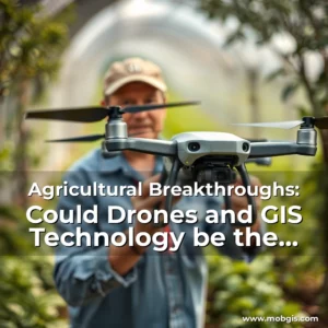
Agriculture represents another transformative domain for GIS implementation:
Precision farming relies heavily upon GIS-derived soil composition analyses and crop health indicators obtained through multispectral imaging drones. Farmers can then apply fertilizers selectively based on nutrient deficiencies identified within specific field zones rather than uniformly treating entire plots inefficiently. Such targeted interventions lead to improved yields without excessive chemical use harming surrounding ecosystems.
Real estate developers employ GIS extensively when assessing property values influenced by proximity factors like schools, hospitals, and recreational facilities. Advanced predictive models incorporating demographic data along with economic forecasts enable smarter investment decisions regarding residential developments versus industrial zoning expansions.
Healthcare institutions increasingly integrate GIS into disease surveillance programs. Mapping outbreaks visually reveals transmission corridors which aid containment efforts dramatically compared to textual reporting alone. Public health officials can simulate contagion spread scenarios considering variables like population density and vaccination coverage rates before implementing mitigation strategies.
Emerging Trends Shaping Future GIS Technologies
As artificial intelligence converges with geospatial analytics, we’re witnessing unprecedented advancements in autonomous decision support systems. Machine learning algorithms now process vast quantities of spatial data autonomously identifying anomalies undetectable through manual inspection alone. For instance, AI-enhanced flood prediction models combine rainfall accumulation patterns with topographical elevation data to issue early warnings far more reliably than conventional forecasting methodologies.
Augmented reality overlays represent yet another disruptive innovation enhancing traditional GIS experiences. Field workers equipped with AR glasses receive contextual information superimposed onto their view of the environment instantly. Urban planners reviewing proposed construction sites could see digital renderings of future structures seamlessly integrated against actual landscapes providing better stakeholder engagement outcomes.
Blockchain technology’s decentralized nature offers compelling possibilities for securing sensitive geospatial records. Land registry systems adopting immutable blockchain ledgers ensure transparent property ownership documentation resistant to tampering attempts. Smart contracts automating transactions related to cadastral surveys streamline bureaucratic processes typically plagued by corruption risks in less regulated markets.
The Internet of Things (IoT) continues expanding GIS functionality through continuous data streams generated by networked sensors deployed strategically around cities. Intelligent traffic lights adjusting signal timings dynamically based on congestion levels measured wirelessly demonstrates practical benefits derived from real-time geospatial data feeds processed continuously by backend GIS servers.
Cross-platform compatibility remains crucial as hybrid app development frameworks gain popularity among GIS vendors aiming to deliver consistent user experiences across desktop computers, tablets, and mobile phones simultaneously. Progressive web apps leveraging geolocation APIs facilitate immediate map loading regardless of device type ensuring uninterrupted workflow continuity even when transitioning between workstations.
Choosing the Right GIS Solution for Your Organization
Selecting appropriate GIS software requires careful evaluation of organizational needs aligned with available technical expertise and budget constraints. Begin by clearly defining objectives such as whether primary functions involve basic mapping tasks versus advanced analytical modeling requirements demanding specialized toolsets.
Consideration must be given towards system integrations necessary for existing enterprise architectures including compatibility with CRM platforms, ERP suites, or other legacy IT infrastructures already in place. Seamless data exchange protocols between disparate systems enhance overall operational efficiency reducing redundant data entry efforts manually reconciling conflicting information sets.
User training considerations shouldn’t be overlooked either; some GIS packages require extensive certification courses before achieving proficiency whereas others feature intuitive drag-and-drop interfaces suitable for non-technical staff members needing occasional map generation capabilities only.
Evaluating total cost of ownership involves more than initial purchase price assessments since recurring expenses might arise from subscription renewals, hardware upgrades, or third-party plugin licensing fees required for full feature utilization. Hidden maintenance charges often surprise administrators unprepared for unexpected service interruptions affecting mission-critical operations unexpectedly.
Trial versions provided by many GIS providers serve as valuable testing grounds allowing teams to experience firsthand what functionalities are most beneficial prior committing long-term financial commitments. Feedback gathered during pilot implementations guides final selection decisions ensuring chosen solutions match both strategic goals and day-to-day workflow demands precisely.
Training and Skill Development in GIS Technology
Proficiency in GIS software necessitates ongoing education due to rapid technological evolution occurring within this field constantly introducing new features and paradigms. Academic institutions worldwide now offer dedicated degree programs focusing specifically on geomatics engineering equipping graduates with theoretical foundations complemented by hands-on laboratory exercises utilizing industry-standard tools.
Professional certifications play vital roles certifying competence levels attained by practitioners aiming advancement opportunities within their careers. Organizations like Esri maintain globally recognized accreditation programs validating mastery of ArcGIS suite functionalities while other entities specialize niche areas such as drone surveying or catastrophe risk assessment simulations.
Online learning platforms democratize access to quality instructional materials previously restricted mainly to university settings. MOOCs (Massive Open Online Courses) hosted by prestigious universities provide flexible study options covering everything from introductory mapmaking basics up through sophisticated spatial statistical analysis techniques applicable research environments.
Workshops and conferences remain irreplaceable venues fostering peer networking connections essential for career growth trajectories particularly beneficial emerging professionals seeking mentorship guidance navigating complexities inherent starting out in specialized disciplines requiring interdisciplinary knowledge bases spanning computer sciences and earth sciences domains concurrently.
Hands-on practice remains foundational component skill acquisition irrespective formal educational backgrounds pursued individuals. Engaging personal projects applying newly learned competencies reinforces understanding acquired theoretically classroom instruction helping bridge conceptual gaps arising abstract representations encountered textbooks versus tangible results produced real-world application contexts.
Future Directions in GIS Innovation
Looking ahead, quantum computing promises revolutionary breakthroughs transforming how complex spatial problems get solved instantaneously once implemented successfully commercially. Quantum algorithms’ capacity parallel processing exponentially increases solution space explored within seconds resolving previously intractable logistical challenges facing global supply chain managers dealing multidimensional constraint satisfaction puzzles daily.
Immersive virtual reality environments constructed entirely from GIS data offer novel ways exploring planetary surfaces virtually before embarking expensive exploration missions. Astronomical agencies simulating Martian terrains inside VR headsets enables engineers test rover navigation paths safely eliminating costly trial-and-error procedures performed physically hazardous extraterrestrial locations remotely.
Bioinformatics intersects intriguingly with geospatial analysis opening avenues studying ecological footprints correlated genetic diversity distributions across biomes. Researchers tracing evolutionary pathways species migration histories discover correlations between climatic shifts historical events shaping current biological landscapes inform conservation initiatives prioritizing vulnerable habitats urgently need protection measures.
Urban resilience planning benefits substantially integrating GIS with smart city infrastructures deploying resilient communication networks self-sustaining energy grids interconnected sensor nodes collecting real-time feedback environmental conditions. Predictive analytics applied against this rich dataset allows municipalities proactively address vulnerabilities identified early warning signals mitigating damage caused natural disasters preemptively.
Continued miniaturization electronic components facilitates wearable GIS devices embedding location-awareness directly within clothing items accessories augmenting situational awareness first responders firefighters paramedics operating dangerous environments enhanced visibility spatial orientation critical moments life-saving interventions occur swiftly accurately.
Conclusion
GIS software stands at the forefront of spatial technology revolution reshaping how societies perceive understand interactions with physical world. Its influence permeates countless facets modern existence from everyday navigation experiences smartphone applications guiding pedestrians through unfamiliar territories effortlessly.
By embracing evolving innovations responsibly balancing progress ethical implications, stakeholders across domains contribute positively toward building sustainable futures grounded robust geospatial intelligence capabilities. Whether addressing climate change mitigation strategies improving public safety responses, GIS remains pivotal instrument empowering humanity navigate ever-changing landscape intelligently decisively.
news is a contributor at MobGIS. We are committed to providing well-researched, accurate, and valuable content to our readers.