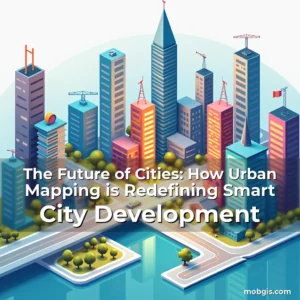
The Future is Mapped: Revolutionizing Urban Spaces Through Smart City Mapping Technologies
In an era where urban populations are projected to reach nearly 70% by 2050, the concept of smart cities has evolved from futuristic speculation to urgent necessity. At the heart of this transformation lies smart city mapping – a powerful blend of geospatial technologies, real-time data analytics, and advanced infrastructure that redefines how we perceive, manage, and interact with our urban environments.
This article explores the cutting-edge advancements shaping smart city mapping today, examining its core components, transformative applications across various sectors, challenges faced during implementation, future trajectories, and ultimately, the role each stakeholder plays in building sustainable, intelligent metropolises ready for tomorrow’s demands.
The Foundations of Smart City Mapping Technology
Smart city mapping begins with establishing robust digital twins – virtual replicas of physical environments created using LiDAR scanning, satellite imagery, and IoT sensor networks. These highly accurate representations serve as dynamic platforms for simulating scenarios ranging from traffic flow optimization to disaster response strategies.
Integration with Geographic Information Systems (GIS) provides multidimensional layers of spatial data that go beyond simple location information. By combining demographic trends, environmental factors, transportation patterns, and utility network statuses within a single interface, planners gain unprecedented visibility into complex urban ecosystems.
Data collection forms the bedrock of any effective mapping initiative. Modern implementations utilize crowdsourced inputs through mobile apps, vehicle telematics systems, and even social media feeds to create living maps that evolve continuously rather than relying solely on static datasets.
Advanced machine learning algorithms process these vast amounts of incoming information at incredible speeds. They detect anomalies such as sudden road closures, unexpected crowd formations, or equipment failures before they escalate into full-blown crises requiring emergency intervention.
- LiDAR technology: Provides centimeter-level precision for creating three-dimensional models useful in everything from construction planning to flood risk assessment
- Satellite imagery: Offers global coverage capabilities essential for monitoring large-scale changes affecting entire regions simultaneously
Evolving Applications Across Key Sectors
Transportation management represents one of the most visible transformations enabled by smart mapping solutions. Real-time visualization tools now allow authorities to dynamically reroute public transit based on current conditions rather than pre-set schedules determined months earlier.
Predictive maintenance systems integrated with GIS data can identify potential infrastructure issues long before they become critical problems. For instance, sensors embedded in bridges monitor structural integrity while thermal imaging detects early signs of electrical faults in power grids.
Urban Mobility Innovations
A recent study conducted by MIT revealed that cities implementing intelligent mobility mapping saw up to 38% reductions in average commute times. This improvement stems not only from optimized routes but also from better coordination between different modes of transport including autonomous vehicles and bike-sharing programs.
Drones equipped with high-resolution cameras provide aerial surveillance capabilities crucial for managing events, responding to emergencies, or inspecting hard-to-reach areas without disrupting ground operations. Their integration with existing mapping frameworks enables seamless transition between overhead views and street-level perspectives.
Enhancing Public Safety Through Intelligent Surveillance
Cities worldwide are leveraging enhanced mapping technologies to bolster security measures while maintaining privacy concerns central to ethical implementation guidelines. Heatmaps generated from CCTV footage combined with behavioral pattern analysis help predict crime hotspots accurately without infringing upon individual freedoms unnecessarily.
The use of facial recognition technology remains controversial yet undeniably impactful when deployed responsibly. When coupled with anonymized data sets focused purely on movement patterns instead of identifying individuals specifically, it becomes possible to track suspicious activities effectively while respecting civil liberties protections.
Sustainable Development Strategies Powered by Spatial Intelligence
Eco-friendly urban planning initiatives benefit immensely from sophisticated mapping techniques capable of analyzing land usage efficiencies over time periods spanning decades. Green space allocation decisions become evidence-based rather than politically motivated choices made without sufficient supporting data.
Energy consumption tracking via smart meters connected to centralized GIS platforms allows municipalities to pinpoint wasteful practices quickly. In Singapore, such approaches helped reduce overall electricity demand by approximately 15% within two years through targeted interventions identified precisely due to granular data availability.
Fostering Citizen Engagement With Participatory Platforms
Successful smart city projects recognize the importance of involving residents actively in decision-making processes related to their neighborhoods’ development paths. Interactive web portals enable citizens to submit feedback regarding local amenities needs, report potholes instantly, or suggest improvements for pedestrian walkways easily accessible via smartphones.
Augmented reality features superimpose proposed developments onto real-world locations allowing stakeholders – whether developers or everyday users – visualize upcoming changes realistically before any actual construction commences. This transparency fosters trust among communities who might otherwise feel excluded from urban renewal discussions.
Challenges Facing Implementation & Solutions Being Explored
Despite numerous benefits associated with adopting smart mapping solutions, several obstacles hinder widespread adoption globally. Chief among them are interoperability issues arising from disparate software platforms used across departments within municipal governments.
Data standardization efforts aim to resolve compatibility problems preventing smooth exchange of information between different systems. Initiatives like Open Geospatial Consortium standards promote universal formats ensuring consistency regardless of which vendor’s products are being utilized locally.
Budget constraints often prevent smaller towns from investing heavily in state-of-the-art mapping infrastructures despite clear long-term cost savings advantages. However, cloud computing models offer scalable alternatives reducing upfront capital requirements significantly compared to traditional on-premise installations.
The Road Ahead: Emerging Trends Shaping Tomorrow’s Cities
Quantum computing promises revolutionary advances in processing massive spatial datasets exponentially faster than conventional methods ever could achieve. Its application may soon revolutionize fields like climate modeling where predicting extreme weather events requires immense computational resources currently unattainable.
Blockchain technology offers secure decentralized storage options perfect for handling sensitive geographical records safely against cyber threats while maintaining audit trails showing exactly who accessed what information when.
As augmented reality interfaces continue improving, expect increased adoption rates for immersive simulation experiences helping architects test designs virtually before committing substantial financial investments towards physical prototypes.
Conclusion
Smart city mapping stands at the intersection of technological innovation and societal progress offering unparalleled opportunities for transforming urban landscapes into resilient, adaptive spaces tailored precisely to modern life’s complexities.
By embracing collaborative approaches that prioritize both technical excellence and human-centric values, we can ensure our cities remain vibrant hubs fostering prosperity for generations ahead while preserving ecological balance necessary for sustaining life itself.
news is a contributor at MobGIS. We are committed to providing well-researched, accurate, and valuable content to our readers.