The Transformative Power of GIS Applications Across Industries
GIS applications have revolutionized how we analyze spatial data and make informed decisions across industries. From urban planning to environmental science, their impact is profound.
These tools enable professionals to visualize complex datasets, identify patterns, and predict outcomes with remarkable accuracy. Their versatility makes them indispensable in today’s data-driven world.
Understanding the Foundations of GIS Technology
Geographic Information Systems (GIS) integrate hardware, software, and data to capture, manage, analyze, and present all forms of geographically referenced information.
This technology allows users to create maps that show relationships between various elements such as population density, infrastructure locations, and natural resources.
The core components include input devices, databases, analytical tools, and output mechanisms that work together seamlessly.
Modern GIS systems are built upon robust platforms capable of handling vast amounts of spatial data efficiently.
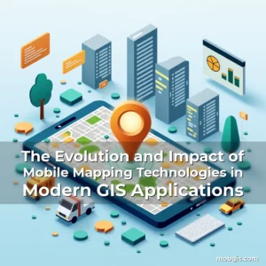
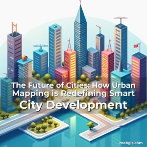
Urban Planning and Smart Cities Development
In urban environments, GIS applications play a critical role in city planning by providing accurate spatial analysis tools.
Planners use these technologies to assess land use changes, optimize transportation networks, and ensure sustainable development practices.
For example: GIS can model traffic flow patterns to help design efficient road systems before construction begins.
Moreover, smart cities leverage real-time data from IoT sensors integrated within GIS frameworks for enhanced decision-making capabilities.
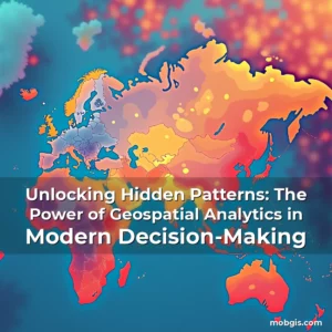
Environmental Monitoring and Conservation Efforts
GIS has become an essential tool in environmental monitoring due to its ability to track ecological changes over time.
Researchers utilize satellite imagery combined with ground-based measurements to monitor deforestation rates accurately.
One key application includes mapping biodiversity hotspots which aids conservationists in prioritizing areas for protection efforts.
Additionally, GIS supports climate change research through modeling scenarios that project future environmental impacts based on current trends.
Wildlife Habitat Analysis Using GIS Tools
Data collected from remote sensing satellites helps scientists understand wildlife migration routes and habitat fragmentation issues effectively.
Conservation organizations employ GIS models to simulate potential effects of human activities on animal populations.
Recent studies indicate that integrating GIS with AI enhances predictive analytics regarding species distribution shifts caused by global warming.
This synergy enables proactive measures aimed at preserving endangered ecosystems against irreversible damage.
Agricultural Advancements Through Precision Farming
Precision agriculture relies heavily on GIS technology to maximize crop yields while minimizing resource wastage.
Farmers use GPS-enabled equipment guided by GIS data to apply fertilizers precisely where they’re most needed without overuse.
Spatial analysis also assists in identifying soil health variations across fields allowing targeted interventions.
Drones equipped with multispectral cameras provide up-to-date field conditions visible via GIS interfaces.
Emergency Response and Disaster Management
During natural disasters or emergencies, quick access to geographic data becomes crucial for effective response strategies.
GIS facilitates rapid assessment of affected regions enabling first responders to prioritize aid distribution based on need levels.
An illustrative case involves hurricane tracking systems which combine weather forecast models with historical disaster records using GIS visualization techniques.
Furthermore, post-disaster recovery plans benefit significantly from spatial analyses highlighting vulnerable infrastructures requiring immediate attention.
Transportation Infrastructure Optimization
The transportation sector benefits immensely from GIS applications designed for route optimization and asset management purposes.
Logistics companies implement advanced routing algorithms powered by GIS to reduce fuel consumption during deliveries.
Real-world examples demonstrate fuel savings exceeding 15% when utilizing optimized paths calculated through GIS software solutions.
Public transit authorities use similar principles to enhance service reliability by adjusting schedules according to passenger demand fluctuations identified via GIS analytics.
Retail Location Strategy and Market Analysis
GIS plays a pivotal role in retail operations particularly concerning site selection processes aimed at maximizing profitability.
Analysts evaluate demographic characteristics along with competitor presence using GIS overlays to determine optimal store placements.
Cross-referencing sales figures against geographical footprints helps retailers refine marketing approaches tailored specifically towards local consumer behaviors.
Innovations in location intelligence now allow stores to adjust inventory levels dynamically based on footfall predictions generated by GIS models.
Healthcare Services Improvement via Spatial Analytics
Integrating healthcare delivery with GIS provides valuable insights into disease spread patterns facilitating timely public health interventions.
Hospitals deploy GIS platforms to map emergency room utilization rates helping administrators allocate staff resources appropriately.
Notably, during outbreaks such as pandemics, GIS enables epidemiologists to trace infection clusters rapidly improving containment efforts.
Telemedicine services increasingly rely on GIS-derived patient density maps to strategically position mobile clinics in underserved areas.
Educational Institutions Leveraging GIS for Research Purposes
Academic institutions incorporate GIS into curricula offering students hands-on experience analyzing real-world problems.
Graduate programs specializing in geography often require coursework focusing exclusively on mastering GIS methodologies.
Universities conduct joint projects involving multiple disciplines demonstrating interdisciplinary applications of spatial technologies.
Research initiatives supported by GIS contribute significantly toward solving complex societal challenges ranging from poverty alleviation to crime prevention strategies.
Future Trends Shaping the Evolution of GIS Applications
Emerging technologies continue reshaping the landscape of GIS with artificial intelligence playing a central role in automating data interpretation tasks.
Cloud computing offers scalable storage options ensuring seamless accessibility of massive spatial datasets globally.
Advances in machine learning promise even greater precision in predicting phenomena like urban growth trajectories or ecological succession patterns.
Collaboration among stakeholders including governments, private sectors, and academia will be vital in harnessing these innovations responsibly.
Conclusion
GIS applications have permeated virtually every aspect of modern life transforming traditional methods of spatial data handling forever.
To stay ahead in our evolving digital era embracing GIS literacy equips individuals and organizations alike with powerful tools necessary for making smarter choices impacting both people and planet positively.
news is a contributor at MobGIS. We are committed to providing well-researched, accurate, and valuable content to our readers.