The Field Accuracy Budget
An error budget for field measurements: the band on a map reading, the squared scale for areas, digits against the GPS fix, the band on a walked boundary, datums, feet and declination, and whether your method fits the job before you order or buy
MobGIS's Map Scale Calculator, Area Unit Converter and GPS Precision Calculator each answer one question exactly, and none of them says how far off that answer can be in the field. The map scale tool converts a reading with no reading error and no check for a resized print; the area converter never meets the map scale, although an area scales by the denominator squared; and the GPS precision tool reports what a digit resolves, not how accurate the fix behind it was. The pack puts a number on every source of error and adds them into one budget set against the tolerance your job allows. Example: a 180 m x 120 m field read off a 1:24,000 map is 21,600 m² (5.34 acres), but half a millimeter of ruler on each side moves it by 17.3%; walked with a phone good to 4.9 m under open sky (GPS.gov's figure), the worst-case band is 14.1%. Both miss a 10% seed-order tolerance, a 1 m fix fits at 2.8%, and a square field of 9.96 acres or more fits with the phone you already have. It also covers a 93% print reading 7% short, Web Mercator planar area, decimal places, WGS 84 against NAD 83, the retired U.S. survey foot, and true against magnetic bearings. Every figure is computed from the site's own calculators and tagged as an example; sources (GPS.gov, NOAA, NIST, the National Park Service) are quoted word for word. It is not a land survey and marks no property boundary: for a property line, hire a licensed land surveyor. In the backcountry carry a paper map and a compass as a backup. Included: 25 printable pages with 7 steps, an accuracy budget sheet, a map measurement worksheet, a fix and datum log, a two-walk check, reference tables and a quickstart, plus a personalised sheet worked out from the numbers you enter in the calculators.
Look inside
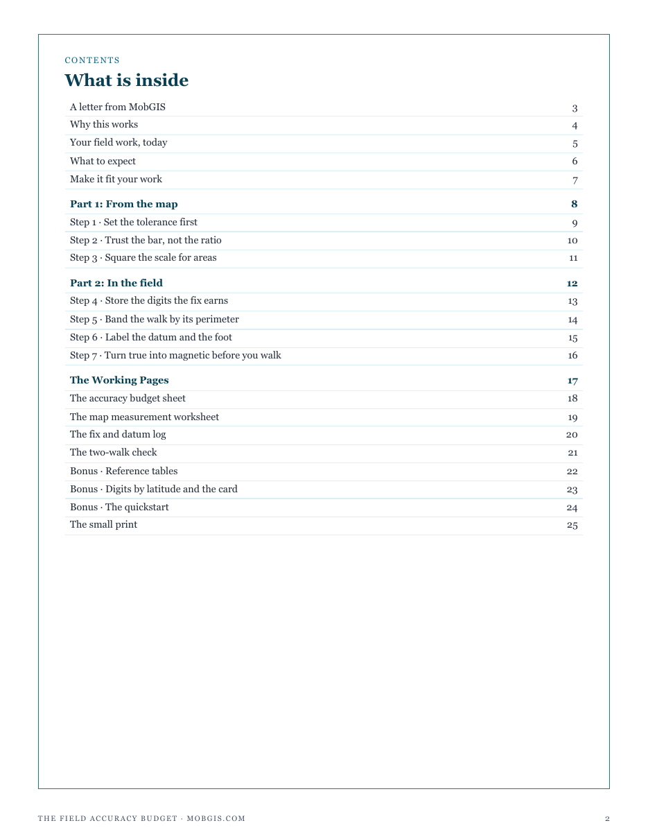
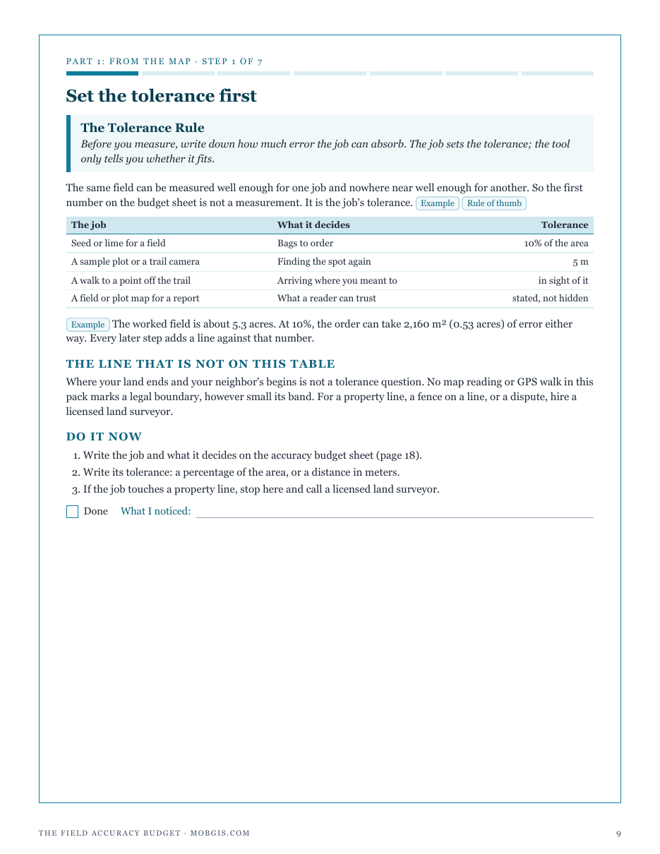
Two full pages from the pack, exactly as printed. Click either to read it at full size before you decide.
What is in it
- Step 1: set the tolerance first: the error each job can absorb, and why a property line is not on the list
- Step 2: trust the bar, not the ratio: a resized print, the scale bar check and the half-millimeter reading error
- Step 3: square the scale for areas: what a square centimeter of map covers, the area band, and Web Mercator planar area
- Step 4: store the digits the fix earns: decimal places against a phone fix, and the budget for finding a point again
- Step 5: band the walk by its perimeter: the worst case on a walked field, and when the phone is enough
- Step 6: label the datum and the foot: WGS 84 against NAD 83, and the international against the U.S. survey foot
- Step 7: turn true into magnetic before you walk: declination, heading error by distance, and a paper map and compass backup
- Working pages: an accuracy budget sheet, a map measurement worksheet, a fix and datum log, and a two-walk check
- Reference tables: what the map hides at eight common scales, the smallest field a walk can measure, and digits by latitude
- A quickstart, the arithmetic on one card, and a personalised sheet worked from your own calculator figures
- ✓ 25 printable pages
- ✓ 10 sections, worksheets and templates
- ✓ A second PDF worked out from the numbers you enter
- ✓ No account needed, just an email address
- ✓ Instant download; link valid 7 days
Price includes any taxes. Sold by GrabURL, who handle checkout and support. The charge appears on your statement as GrabURL.
The pack picks up where the free Map Scale Calculator leaves off. That tool turns a map reading into a ground distance exactly; the pack puts a band on it, checks a resized print against its scale bar, and squares the scale for areas, which the Area Unit Converter cannot do on its own. It sets the GPS Precision Calculator's digits against the accuracy of the fix behind them, bands a walked area by its perimeter, and labels datums, feet and declination. It is not a land survey and marks no property boundary; for a property line, hire a licensed land surveyor. In the backcountry, carry a paper map and a compass as a backup. Every figure in it is an example for you to replace.